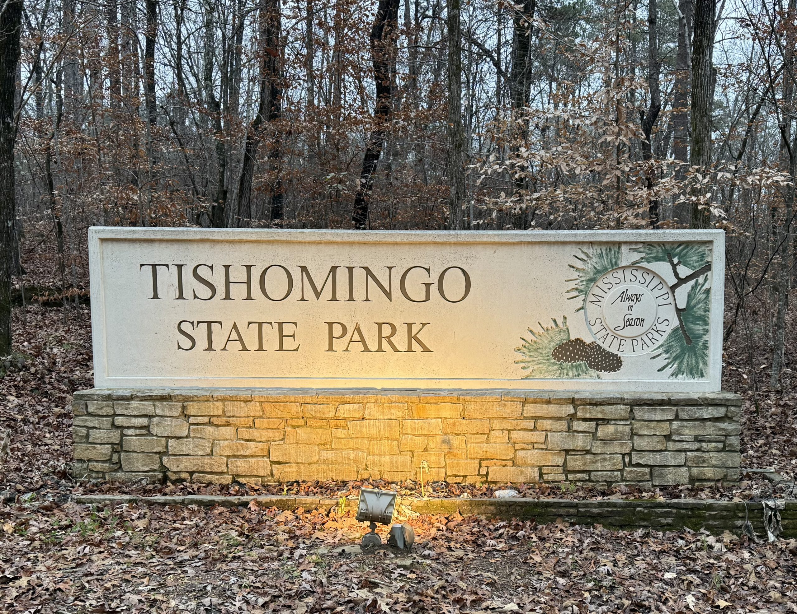
On December 4, 2025, we packed up and pointed the truck toward Tishomingo State Park in the great state of Mississippi. It was about a five-hour drive, and—true to recent tradition—we did our best to outrun the incoming rain. Also true to tradition, the rain didn’t care. Most of our trip, and all of our miles inside Mississippi, were spent plowing through a cold, steady downpour with a friendly 10-mph crosswind trying to reorganize the truck.
We arrived soggy but safe and settled into Site 57. The site sits right on the lakeshore with wide, open space and actual privacy—acres more than our tight little corner back at Hot Springs National Park. The cold rain kept us company through setup. The aluminum stairs up to the roof (where I mount the Starlink antenna) were approximately as slippery as ice. Thankfully, the operation ended with only minor frostbite and no broken bones. Once everything was up and running, we dove into the trailer, fired up the furnace, and officially entered hibernation mode for the night.
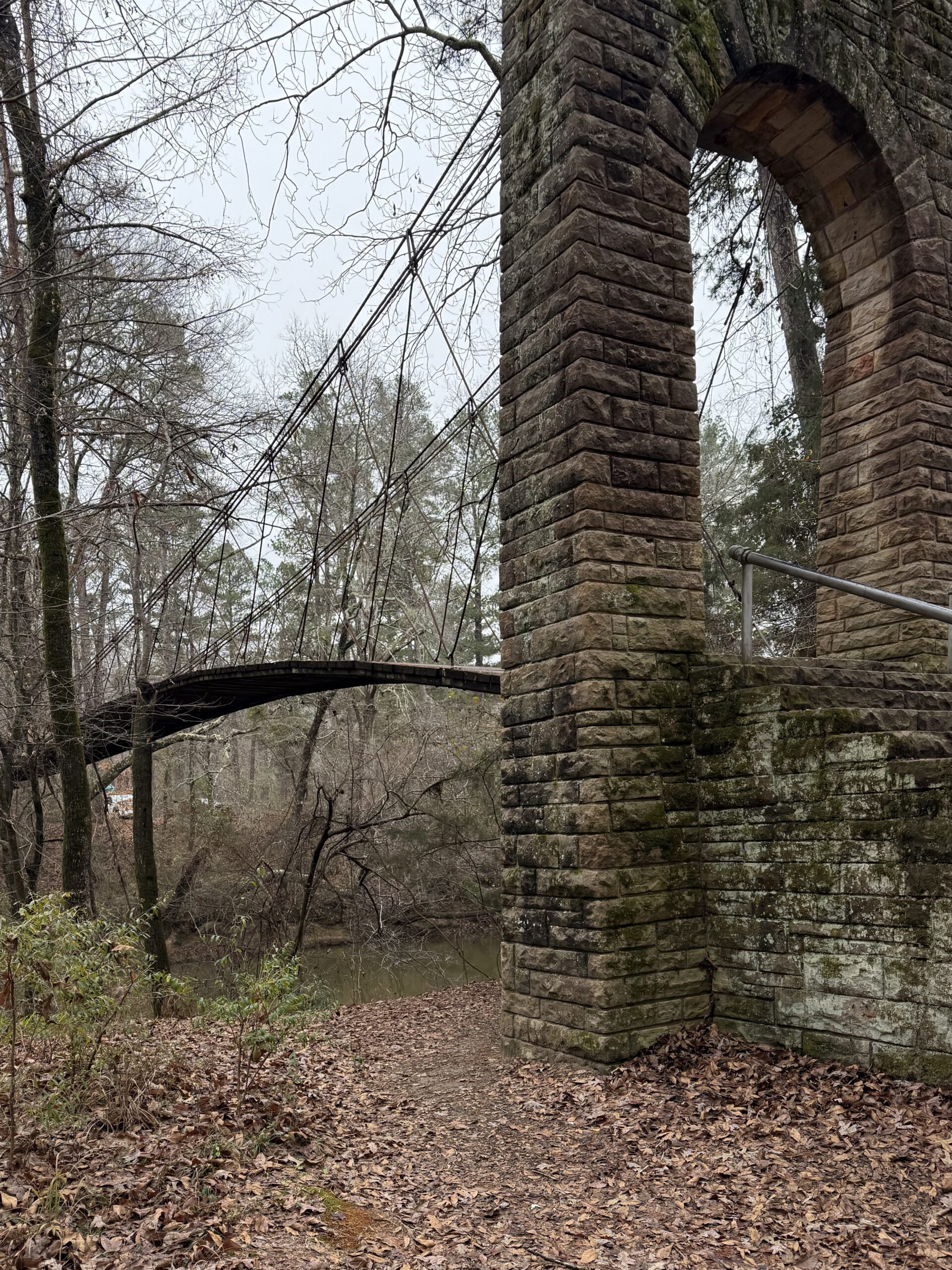
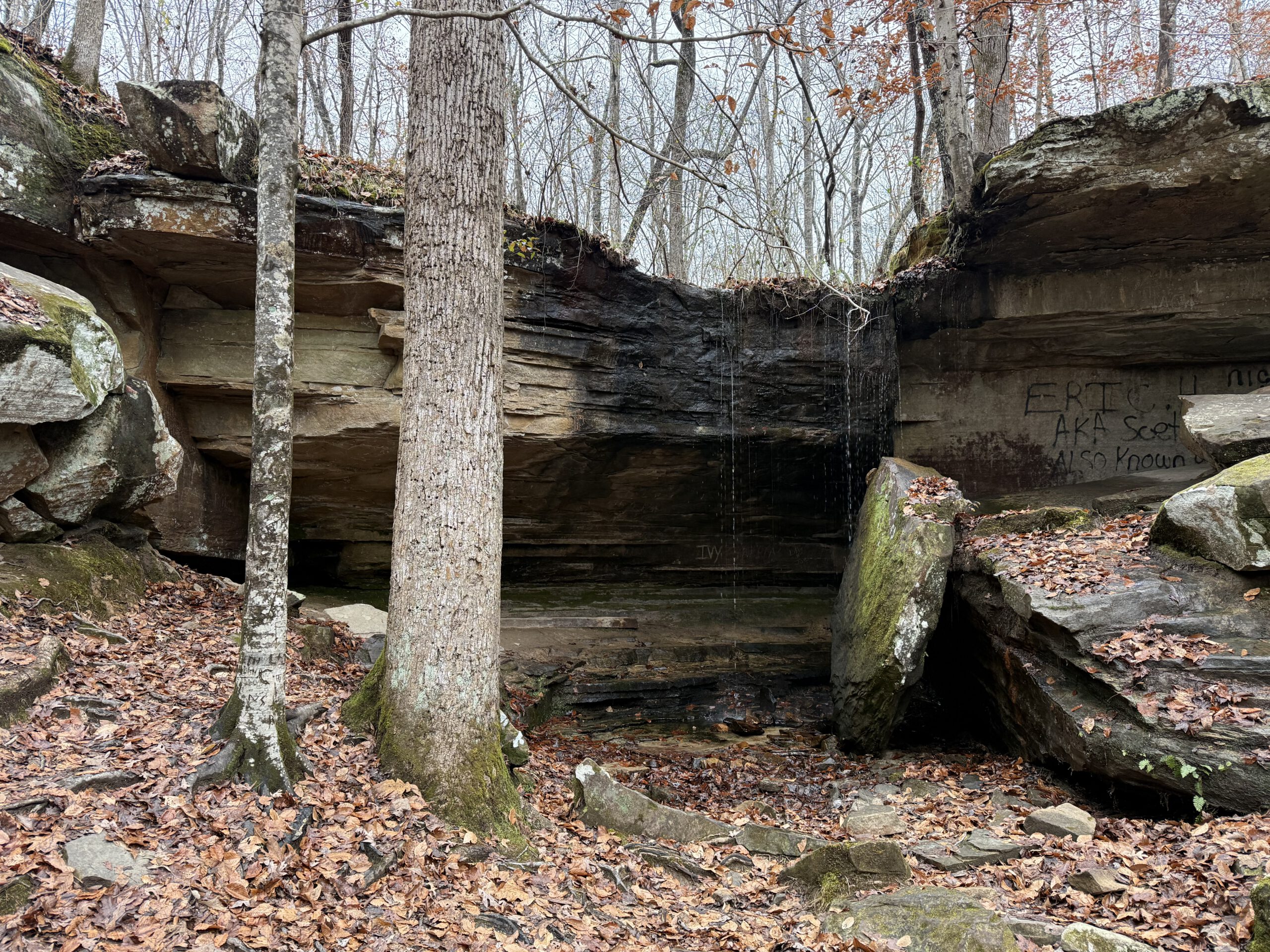
The next morning we thawed out, emerged from our den, and set out to explore the park. First stop: the Swinging Bridge Trail. We crossed the bridge—helping it live up to its name—and followed the trail northeast along Bear Creek. We eventually reached a small hidden waterfall that you can walk behind, which we did, because who passes up the chance to recreate every childhood fantasy movie scene? We had a picnic lunch, then continued on until we found a rocky outcropping we immediately named Lion King Rock, because it looks uncannily like Pride Rock. Naturally, we climbed it. The top of the cliff was a miniature forest growing straight out of the stone, with moss filling the gaps like nature’s carpeting.
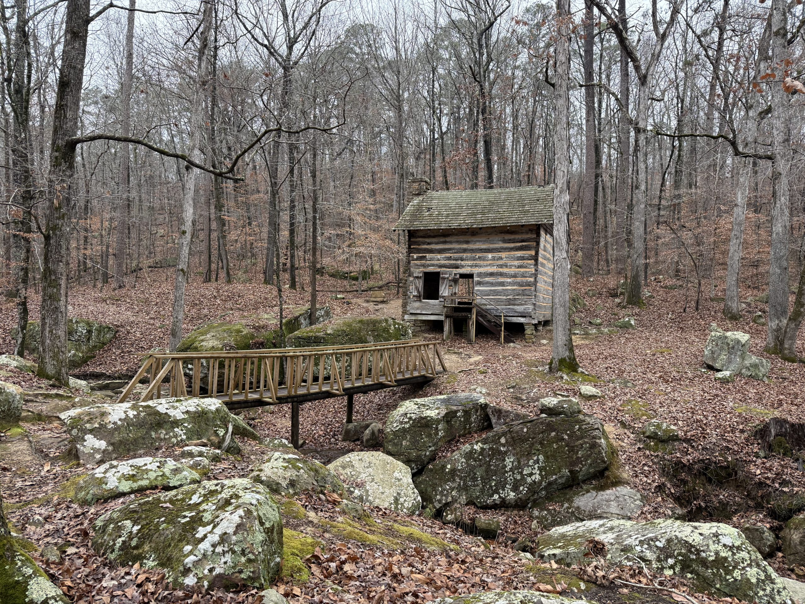
As we drove through the park we came across an old cabin perched by a small stream. The cabin and its stone dam were built in the early 20th and stand mostly intact. The dam stands about 15–20 feet tall and forms a medium-sized pond, though the water just flows over a spillway and back into the creek. There’s no visible system for diverting water elsewhere or generating electricity. Your guess is as good as ours—ice harvesting? washing mules? early Mississippi backyard water feature? The historical signs didn’t say, so we’re left to imagine.
The Natchez Trace Parkway cuts right through Tishomingo State Park—well, technically above it over a couple of graceful bridges. The Parkway is nearly 500 miles long and follows a historic travel corridor used for thousands of years—archeologists estimate people have been walking it since around 8000 BC. Today it’s a National Park Service road lined with pullouts, short trails, and historic sites ranging from Native American mounds to old inns and trading posts.
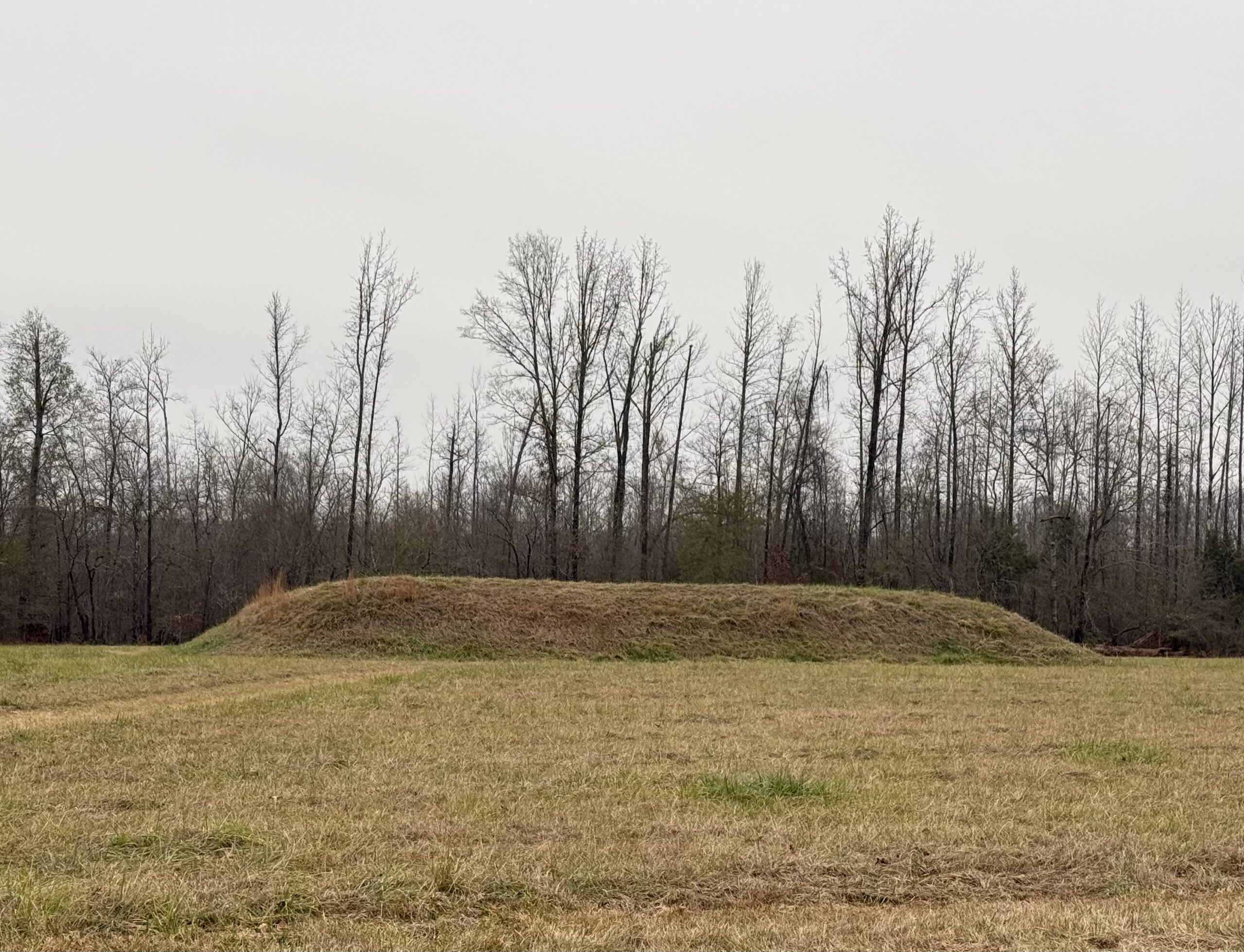
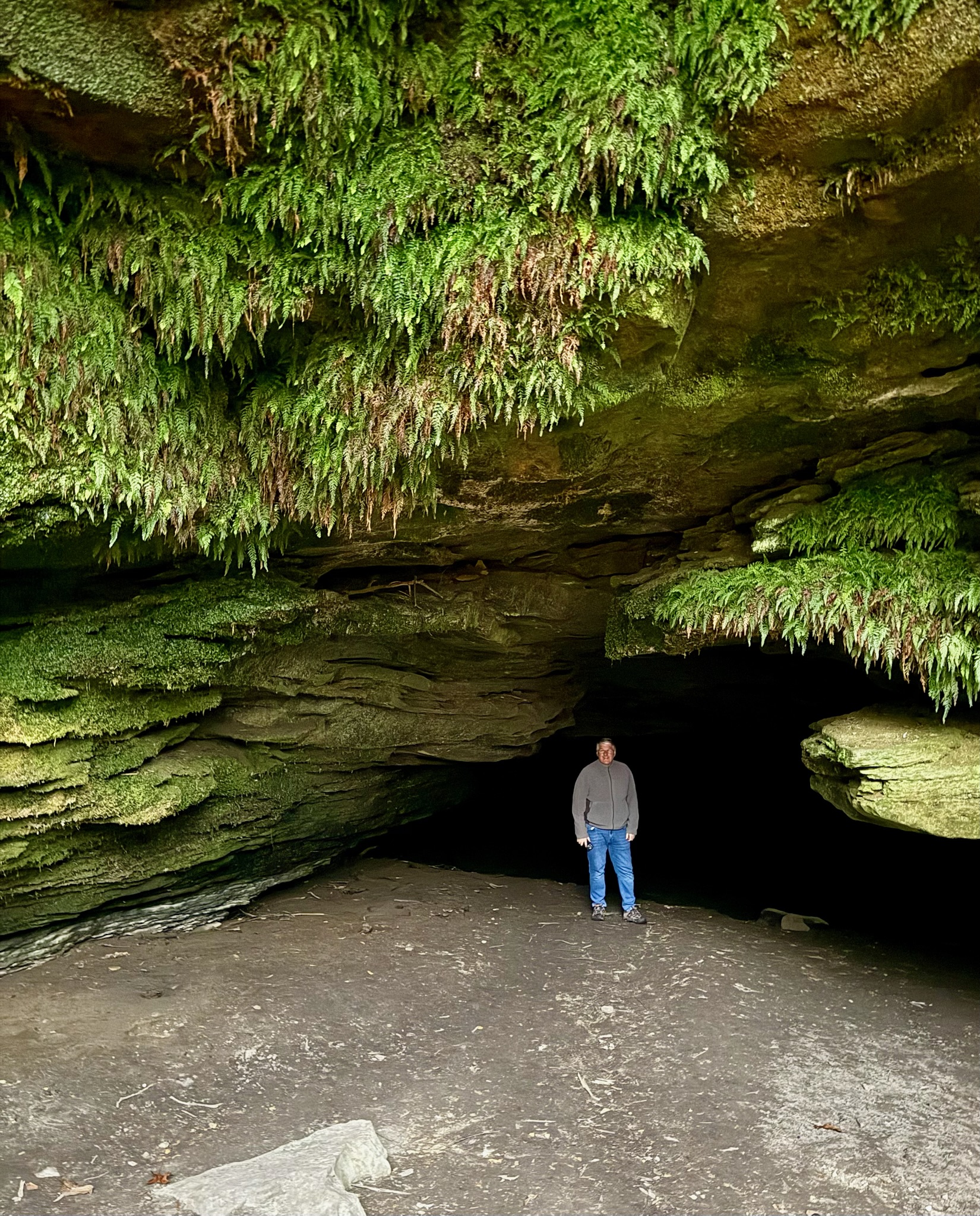
We exited the park and joined the Parkway to visit two nearby sites. Our first stop was Bear Creek Mound, built around 1000 AD. Archaeologists believe the people of that era constructed temples or ceremonial structures on top of platform mounds, so we climbed up and tried to look appropriately reverent. Our second stop was Cave Spring, once a water source but now labeled as not-safe-for-drinking (and the cave itself is posted as dangerous). Naturally, we went in anyway—but only as far as the safe zone. Adventure, not stupidity.
After our little history tour, we headed back to camp, rustled up dinner, and prepared for an early departure. With an 8 a.m. launch window, we’re aiming for Georgia next—Indian Springs State Park near Jackson, Georgia, to be exact. Eastward we go!
| Nights | Total Nights | Miles | Total Miles |
|---|---|---|---|
| 2 | 317 | 317 | 29763 |